
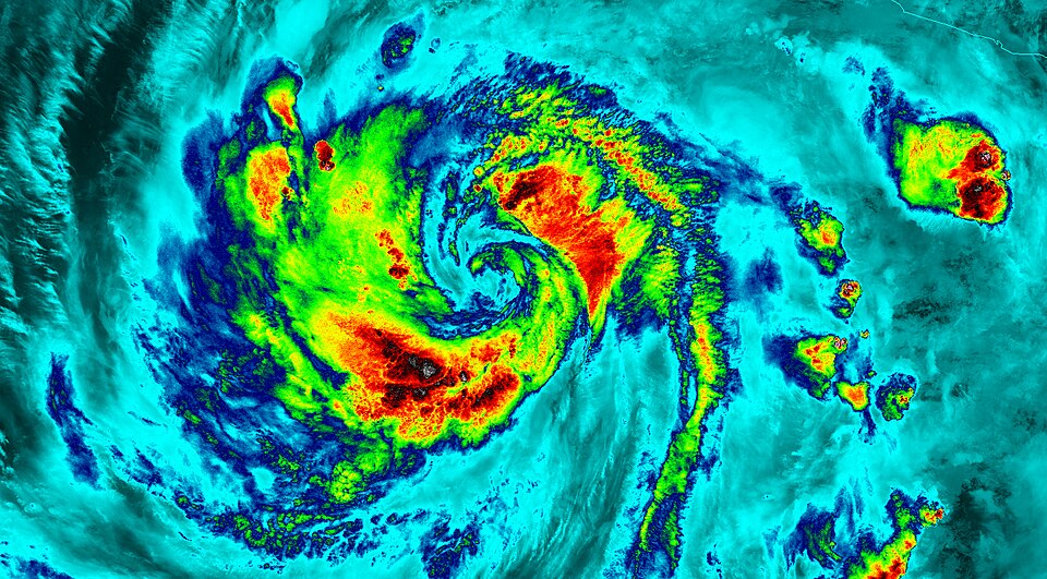
Hurricane Polo Strengthens To Category 5 Off Southwestern Mexico Coast
Hurricane Polo intensified to a Category 5 storm with 160 mph sustained winds on Tuesday, Sept. 22, 2026, about 220 miles south of Zihuatanejo, Guerrero, threatening life-threatening flooding and mudslides.[1]
At 6 a.m. Central, Polo was about 220 miles south of Zihuatanejo and 360 miles south-southeast of Manzanillo, moving east at 6 mph.[1] A tropical storm watch covered the coast from Tecpan de Galeana to Manzanillo, with forecasts of up to 12 inches of rain and life-threatening flooding and mudslides in parts of Guerrero and Michoacán.[1]
Polo strengthened quickly over warm Pacific waters in the days before Sept. 22, undergoing rapid intensification that pushed it to Category 5 strength.[1]
Officials urged residents along the southwestern Mexican coast to monitor forecasts and heed local warnings as the storm approaches.[1]
Show source details & analysis (1 source)
📌 Key Facts
- On Tuesday, September 22, 2026, Hurricane Polo intensified to Category 5 strength with 160 mph sustained winds.
- At 6 a.m. Central, Polo was about 220 miles south of Zihuatanejo, Guerrero, and 360 miles south-southeast of Manzanillo, Colima, moving east at 6 mph.
- A tropical storm watch covers the Mexican coast from Tecpan de Galeana to Manzanillo, with forecasts of up to 12 inches of rain and life-threatening flooding and mudslides in parts of Guerrero and Michoacán.
📰 Source Timeline (1)
Follow how coverage of this story developed over time